中國歷史地理信息系統
中國歷史地理信息系統(CHGIS)是一個歷史地理信息系統計劃,包含關於中國歷史從公元前221年到1911年地點和行政區劃的空間數據集。CHGIS追蹤地名、行政級別和地理的變遷。他是一個由哈佛大學費正清中國研究中心和復旦大學歷史地理研究所合作的計劃。主編為哈佛的包弼德教授Peter K. Bol[1]和復旦的葛劍雄教授,執行編輯為哈佛的貝明遠和復旦的滿志敏。[2]詳細信息可見:CHGIS主頁。
Contents
電子地方志和API
CHGIS的數據可以在此搜索:Temporal Gazetteer。
TGAZ API是個只能閱讀、不能修改的界面,提供對「中國歷史地理信息系統」地名數據的搜索。TGAZ系統是建立在2006年的CHGIS XML API基礎之上,經過優化之後,數據已經經過標準化,並整合了多個數據源的數據,並對多種語言的拼寫方法實行兼容。
界面實現了地名以UTF-8編碼字串或單字的搜索(例如是繁體和簡體中文)。每個地名在資料庫中的記錄都是以一種拼寫來呈現。計劃的數據以圖表來呈現,可以參考:(PDF)。也可以參考影片:YouTube
目標和內容
The main objective of the CHGIS project is to create a flexible tool, in the form of a documented database of places and administrative units, which can be used to investigate any sort of geographically specific data related to China's imperial history. The unique ID numbers for each of the CHGIS temporal instance records can be used as geocodes in relational databases, or to mark up texts, enabling users to import their own datasets into the CHGIS platform. Users will be able to associate their own data with CHGIS records, and then use the CHGIS database to sort, query, and display their data for different historical periods and at different levels of aggregation.
The CHGIS project has been working backwards from county basemaps for the year 1911, to create a continuous time series of records that track changes in placename, administrative status, and geographic locations. It should be noted that the data for the year 1911 CE is time slice valid for a single year, and the content overlaps the time series data.
There have been six versions of CHGIS data released between (2002 - 2016), providing base coverage of the so-called core provinces of Dynastic China: Anhui, Fujian, Gansu, Guangdong, Guangxi, Hainan, Hebei, Henan, Heilongjiang, Hubei, Hunan, Jiangsu, Jiangxi, Jilin, Liaoning, Ningxia, Shandong, Shaanxi, Shanxi, Sichuan, Yunnan, Zhejiang.
The following provinces lie outside the scope of the current project for Time Series data: Neimeng, Qinghai, Xinjiang, and Xizang. However they do exist in the two Time Slice datasets for 1820 and 1911.
數據集
CHGIS第6版包括以下圖層:
Time Series
All are available in GBK and UTF8 encoding.
NOTE: prefectural level polygons are complete only for the period 1350-1911.
Time Slice 1820
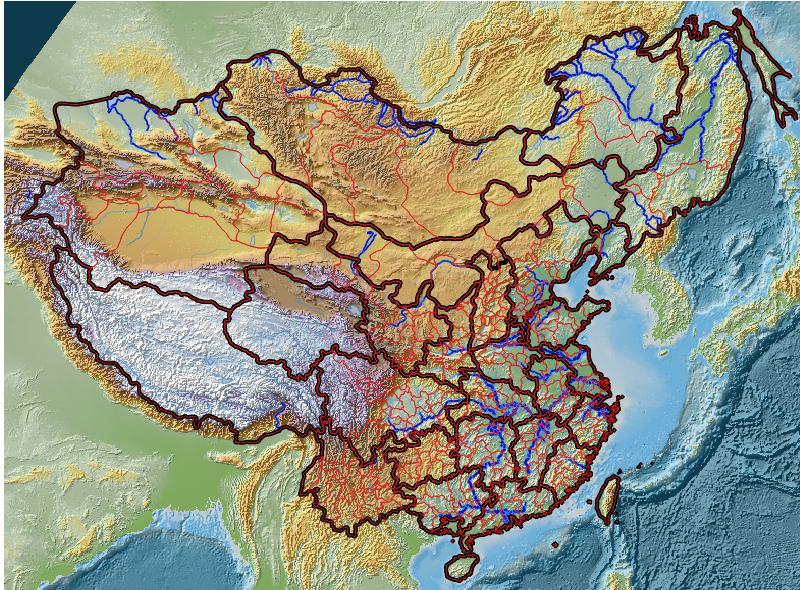
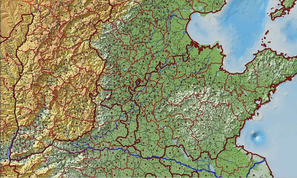
The 1820 Time Slice includes: county, prefectural and provincial level points (administrative seats), township points, prefectural level and provincial level polygons, rivers and lakes.
Time Slice 1911
The 1911 Time Slice includes: county, prefectural and provincial level points (administrative seats), township points, county, prefectural and provincial level polygons.
Time Slice 1990
CHGIS also distributes the CITAS dataset of county, prefectural and provincial polygons as of 1990.
Digital Elevation Model
The basemap image for Digital Elevation was created from GTOP0-30 Nasa dataset, with approximately 1km resolution per pixel. There are two versions available, one for ESRI, one for QGIS, both of which are based on the files: chgis_dem.tif and chgis_hillshade.tif.
Coastline (circa 1820)
The coastline is a vector polyline useful for showing the mouth of the Yellow River to the South of the Shandong Peninsula (near Lianyungang). After the floods of 1850s and 1897, the Yellow River remained in its present course, emptying North of the Shandong peninsula, into the Bohai sea.
Rivers (circa 1820)
The Coded Rivers dataset contains polylines of the the major and minor rivers, with Chinese names for the major rivers. The Strahler Order of the rivers is provided, so that they can be symbolized with graduated sizes, showing the generalized view of minor rivers draining into the major rivers and to the sea.
內容範圍
參見
- China Biographical Database (CBDB)
參考文獻
- ↑ "PETER K. BOL". Harvard University. Retrieved 17 November 2017.
- ↑ Peter Bol; Jianxiong Ge (2005). "China Historical GIS". Historical Geography.

